|
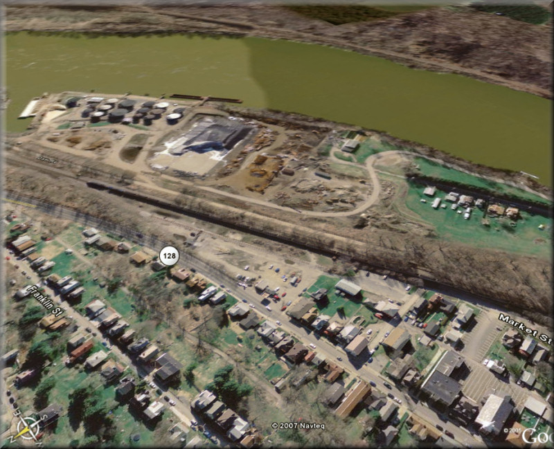
Todd's "Island" is no longer an island. Where the train
tracks (with the train on them)
and the road marked "Dam Rd" are was once the channel between the island and
the
river shore. A portion of the original railbed can seen just to this side of
the newer tracks.
We are looking southeast from above Freeport. The large street marked -128-
is High Street.
The empty triangular area beyond Market Street (which ends at the right of
the photo)
is where the distillery buildings are shown on the 1876 map. Where the old
map shows
the A. G. & Bros pig pens (and probably the lot that belonged to the
Kennedys) is now
part of the area with the building rubble and the coal pile.
--= Click on photo to return
=--
|